The nice thing about Santorini is how accessible the geology is, both literally and figuratively. The impressive caldera cliffs and the lack of any real vegetation mean that much of the history of the volcano is exposed and with a little geological knowledge a lot can be learnt from those cliffs. I thought I would share some of the photos I took and explain how they reveal their history. I also hope to write second part to this post, which will take a more personal look at the work I did.
So first, a brief summary of where Santorini is and what it is doing there. Santorini is a subduction zone volcano, where melting is caused by the subduction of the Mediterranean beneath Crete. It is a highly explosive volcano, and its last big eruption 3,600 years ago is thought to have ended the Minoan civilisation. So let's take a closer look.
The most obvious feature of the island is the massive hole in the middle. This hole, that takes 45 minutes to cross by ferry, is the caldera. Calderas form when a large magma chamber beneath the volcano empties catastrophically, and the roof collapses in. This type of volcano produces some of the largest eruptions, other examples include Crater Lake in Oregon and Taupo in New Zealand.
 Santorini's caldera, from the south of the island looking north. In the centre are the Kamini islands, the most recent volcanic vent.
The caldera at Santorini didn't form all in one eruption, however. There is evidence of at least 4 different caldera collapses, which are usually followed by a period of constructive volcanism. The latest of these periods has built up the Kamini islands, which can be seen in the centre of the picture above. We have good historical records of eruptions on these islands, dating back to 197 BC when the islands first broke the surface of the sea. Since that time thick, viscous, blocky lava flows have added to the islands, growing them to their present size.
The evidence that past cycles also followed a similar pattern are in the cliffs. Below is a photo of the Skaros shield, which would have formed a cone-shaped edifice before it was destroyed by the Cape Riva eruption 22,000 years ago. This would have looked similar to the present Kamini islands, although it grew to be much larger.
On the right in the photo below you can see a series of lava flows that formed the shield. However, they stop against the rocks on the left. This is where the lava flows reached the old caldera wall, showing that there must have been a caldera there to be filled in. When the Cape Riva eruption created its caldera, it exhumed the old wall which is now visible. By carefully mapping the various lava flows and pumice falls, it can be shown that the current caldera is the product of at least four large eruptions.
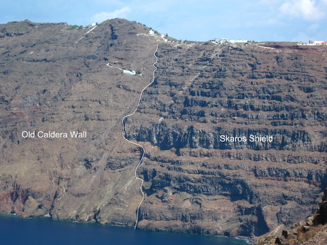
The edge of the Skaros shield, taken from Skaros point looking north. The white line down the centre of the photo marks the edge of the pre-Skaros caldera.
So what do the rocks that make the cliffs look like up close? How can we use them to tell what sort of activity has happened in the past, and what activity is likely to occur in the future? I will leave the lavas for a later post, and look at some of the pyroclastic units that are the result of the more impressive eruptions of the island. First, a slightly unusual unit:
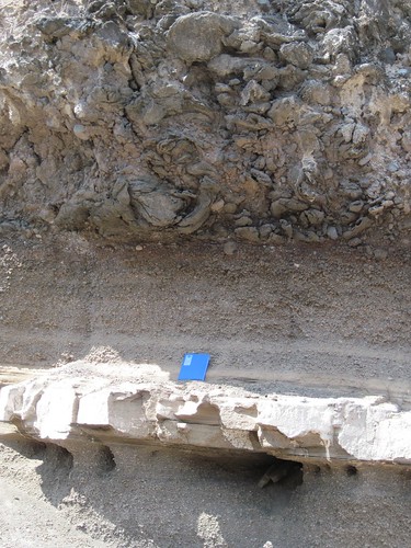
Upper Scoria 1
This part of the Upper Scoria 1 eruption, and the uppermost layer is made of "spatter rags". These were ribbons of gooey magma, emplaced as a pyroclastic flow. Usually, pyroclastic flows contain hot but solid pumices and ash. Here, however, you can see the way the large clasts in the upper unit are all contorted, suggesting they were far more malleable when they were laid down. See the close up below:
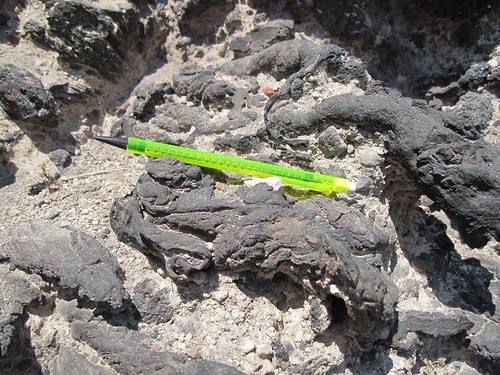
Close up of the "spatter rags"
These ribbons of rock would have still been molten during emplacement, drawn out into their elongated shape as they flowed. Even more terrifying than an ordinary pyroclastic flow! Similar deposits have been found elsewhere, but this was one of the first places they were identified, and this type of flow is still rather exceptional.
So what do normal pyroclastic flow deposits look like? Glad you asked... Here is an example from one of the Lower Pumices:
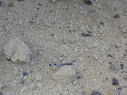 Typical ignimbrite of on of the Lower Pumice
Other flows can carry more chunks of rock ripped up from near the vent ("lithics"). Some of the flows on Santorini, especially those close to the vent, can be so full of lithics it is hard to tell them apart from sedimentary breccias. Following them over distance shows that further form the vent, after the densest clasts have been deposited, these units grade into normal pyroclastic flow units however. They would have been deposited hot, and TRM studies have measured emplacement temperatures of over 300ºC.
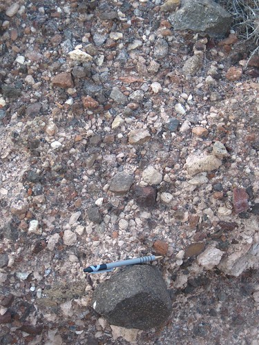
A "lithic lag breccia", made up primarily of lithic clasts and deposited close to the vent.
One of the characteristic features of pyroclastic deposits is their chaotic nature. There is little structure to the unit, and the clasts are a large range of sizes (it is poorly sorted). Compare that to this deposit:
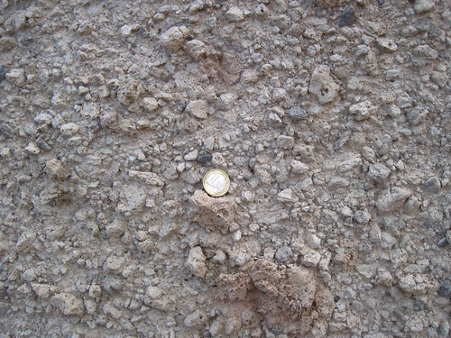
A pumice fall deposit
Here the clasts are more regularly sized. They are mostly pumices again, and this kind of deposit is known as a pumice fall. The regular size distribution is down to the way these pumices are transported - through the air. They are the result of Plinian eruptions, where a column of ash and pumices are sent high into the sky. The particles in them are blown by the wind away from the vent, and as they travel further, the pumices begin to fall. Larger pumices fall first, with fine ash being transported the furthest. This leads to similar sized pumices being found together, as in the photo above.
To finish I want to show a clear example of how awesome the destructive power of this volcano can be. Take a look at this:
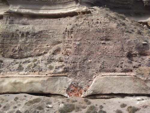
That grey layer the "volcanic bomb" is the pumice fall from above, and about 2m thick. It is the first stage of an eruption that clearly got much more violent. The bomb would have been thrown into the air by the eruption, and you can see here where it landed. The layers above and below are distorted downwards by its impact, and you can see that it shattered as it hit. This is by no means the largest bomb found on the island, but it is one of the nicest. It was these giant, car-sized chunks of rock, left where they had been tossed, that really brought home how powerful a force volcanoes can be.
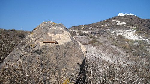
A bomb from the Minoan eruption I stumbled across, on Therasia.
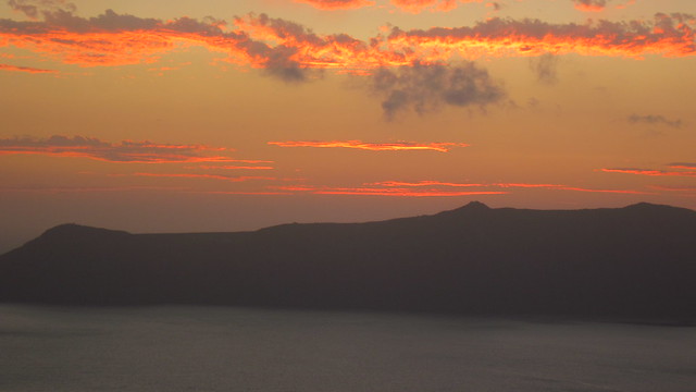
I shall leave you, as became traditional during my degree, with a sunset. If you've made it this far, you may want to follow me on Twitter. Or subscribe to my RSS feed. Or both...?


Comments